After another superb breakfast at the Excelsior Café we set off driving through the city.
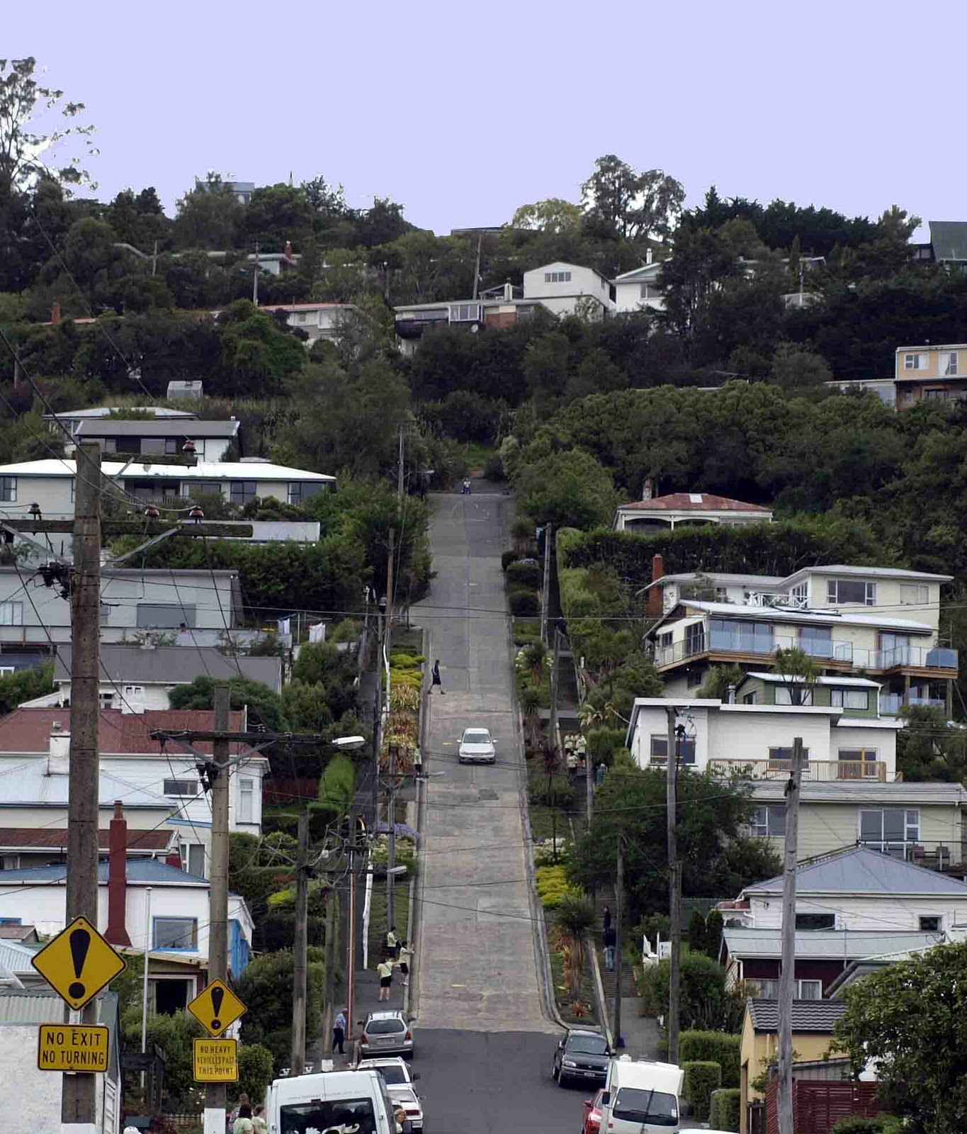
We drove around the Octagon and navigated to Baldwin Street which is the steepest street in the world, according to The Guinness Book of Records. We drove up the street and back down again which was quite scary as it has a gradient of 1 in 2.86.

From Baldwin Street we carried on driving North around the back of Signal Hill which afforded us good views over the sound and the Otago Peninsular where we had been the previous day. The weather wasn’t as kind to us today as it was slightly hazy.
We drove along SH1, which was very scenic, until we came to Palmerston where we stocked up on lunchtime provisions. According to our guide book “There’s little reason to stop long in Palmerston”.
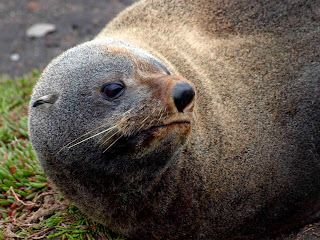
We continued until we arrived at Shag Point where we didn’t see any penguins but we had great views of Fur Seals (almost up close and personal)
and sea birds (and an owl!)


and sea birds (and an owl!)

We drove into Moeraki village where we had a great coffee at Fleur’s Place. This is a very characterful converted fishing shack restaurant/café which serves the freshest of fish. They had produced their own cookery book which not only included photographs of the recipes, but also photographs of the area around Moeraki. The celebrity chef Rick Stein had endorsed the recipes and apparently Gwyneth Paltrow had eaten there when filming in the area. Outside on the cliff were a great number of roosting birds.

We visited the Moeraki Boulders and were amazed by the size of these perfectly spherical boulders, some of which reach 2m in diameter. Contrary to popular myth these boulders have not fallen from the sky, not were they washed up by the sea but rather lay deep in the mudstone cliffs behind the beach. As the sea eroded the cliffs, so these boulders appeared.


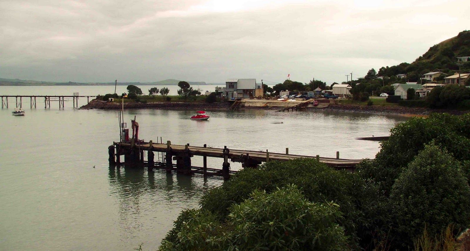
We decided to delay our lunch stop as the car park was full of coaches. We drove north, failing to find a picnic spot so ended up eating lunch (at 3.30pm) overlooking the harbour at Oamaru. We quickly visited the Blue Penguin reserve but as no cameras were allowed in we decided not to bother as we had seen blue penguins yesterday. Here there was another derelict pier with hundreds of roosting sea birds.

Oamaru did not benefit from our patronage as they required us to pay for parking; in any case it was a little too touristy for us.

Oamaru did not benefit from our patronage as they required us to pay for parking; in any case it was a little too touristy for us.
Driving out on SH1 we hit the back of a traffic jam, which seemed to be going nowhere very quickly so we attempted to navigate our way on the back roads. This resulted in us coming back into Oamaru, so we decided to head south and then turn west onto a “red road”, which was signposted Weston. We had to do many educated guesses as the road meandered around and didn’t have signposts, but had road names. It turned out to be a very spectacular road beside limestone cliffs. We drove for an hour and twenty minutes without seeing another car, bliss! We made an unscheduled, but extremely interesting stop at Elephant Rocks, so called because the rocks look like a small herd of elephants, in shape and colour, making their way through a grassy bowl.

After Elephant Rocks we rejoined the main road which we had intended to use. This took us through the unremarkable town of Duntroon and then to some rocks where there should have been Maori rock paintings. Unfortunately, the better drawings have been removed to a museum and we weren’t able to view what was left as there had been a major rock fall.
The road then went past three lakes and three dams, which are producing hydroelectricity. The water in the lakes was the colour of eau-de-nil and it looked as though it had a viscous quality to it.


We drove through countryside that reminded us of the Scottish glens and finally arrived at Omarama where we ate in the dining room to the motel.
No comments:
Post a Comment